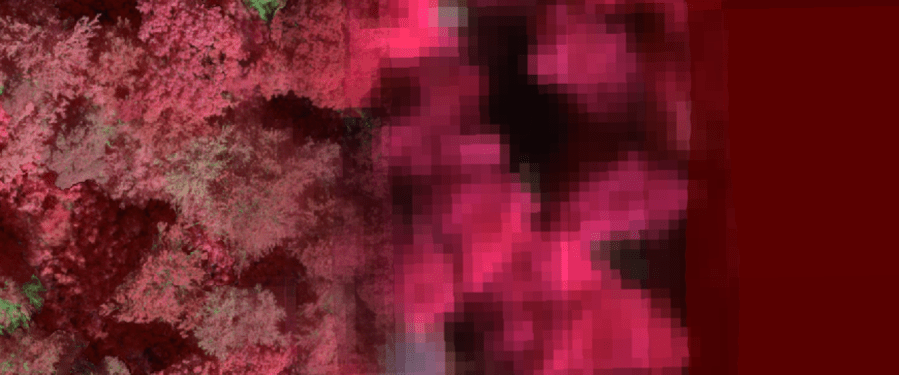
Forest health monitoring is becoming increasingly important as climate change leads to more frequent and severe droughts. Satellites are already widely used to monitor forests, but most current methods only detect relatively late signs of stress, such as reduced greenness or leaf loss. New hyperspectral sensors can measure reflected light in much greater detail and have the potential to detect earlier changes in photosynthesis, pigments and leaf water content, providing a more sensitive way to monitor vegetation vitality.
Before these new satellite missions can be used to monitor forests, we need to understand how well these detailed measurements work across different spatial scales. While leaf-level measurements can capture subtle changes in tree physiology, satellite pixels contain a mixture of leaves, branches, shadows and often several trees.
While quantitative remote sensing is moving away from the use of indices and focuses instead on retrievals using all available bands in a machine learning, radiative transfer or hybrid framework, indices are nonetheless still widely used in interdisciplinary research to map vegetation condition, to detect changes and trends.
In this study, we investigated how well a range of hyperspectral vegetation indices represent tree vitality as measurements are scaled up from individual trees to entire forest landscapes.
To do this, we collected hyperspectral imagery over forests in Switzerland using drones and an aircraft during the summers of 2023 and 2024. We then simulated future satellite observations by reducing the aircraft data to a 30 m resolution. We compared vegetation indices related to photosynthesis, chlorophyll, water content and vegetation structure across these different spatial scales to identify which remain sensitive to drought stress-induced differences when moving from tree crowns to landscape-level observations.
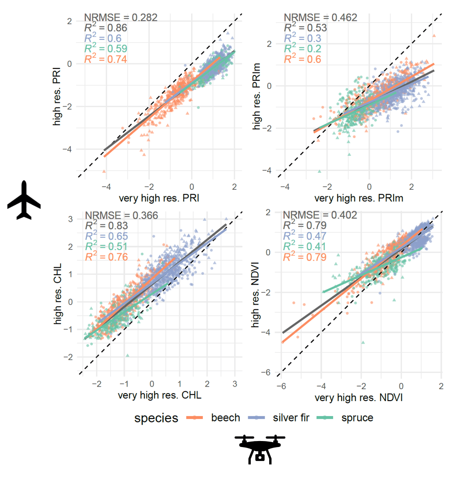
We found that most vegetation indices showed good agreement between drone and aircraft measurements, meaning that subtle differences in tree vitality may still be detected at 1 m resolution (Figure 1). Agreement was generally strongest for broadleaf trees, while conifers were more affected by shadows due to their more complex crown structure. When we simulated satellite observations, most indices still reflected the underlying tree-level patterns, particularly those related to leaf water content. However, several commonly used indices were also strongly influenced by canopy structure, composition and shadows, meaning they cannot always be interpreted as indicators of tree stress alone (Figure 2).
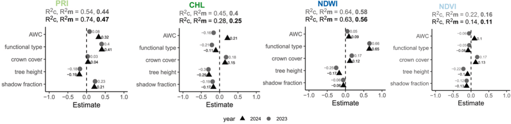
Overall, our results show that the next generation of hyperspectral satellites has great potential for monitoring forest vitality over large areas. At the same time, they highlight that spatial differences in vegetation indices can reflect both tree physiology, forest structure and composition. Taking these structural effects into account will therefore be essential when using hyperspectral satellite data to assess forest health.

